
Landslides in Dominica
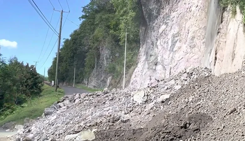
Landslides in Dominica are a natural threat from the island’s volcanic landscape, compounded by heavy rainfall and the impact of frequent tropical storms. Often triggered by hurricanes, extended periods of rain, and deforestation, these landslides dramatically alter the landscape and present significant challenges for the government and communities living in affected areas.
Impact of Landslides in Dominica
For example, Hurricane Maria triggered nearly 10,000 landslides across the island, leaving significant destruction. These landslides caused mass debris displacement and flooding, severely affecting urban and rural areas, including essential rivers like the Layou River and Melville Hall River and coastal regions along the Atlantic Ocean. Dominica’s vulnerable terrain poses a continuous threat, particularly in northern and eastern parts of the island.
Monitoring and Mitigation Efforts
Dominica utilizes advanced satellite technology like InSAR (Interferometric Synthetic Aperture Radar) to combat landslide risks to monitor and map landslide-prone areas. This system helps monitor real-time soil movement, allowing authorities to take proactive measures in disaster preparedness. These efforts are part of Dominica’s broader Climate Resilience and Recovery Plan (CRRP), aimed at mitigating the long-term impacts of natural hazards.
Landslide Risk Reduction
The government focuses on reforestation, better land use practices, and building resilient infrastructure to landslides. Ongoing mapping and monitoring initiatives, including InSAR technology, are crucial to enhancing the country’s preparedness for future landslide events.