

Morne Plat Pays
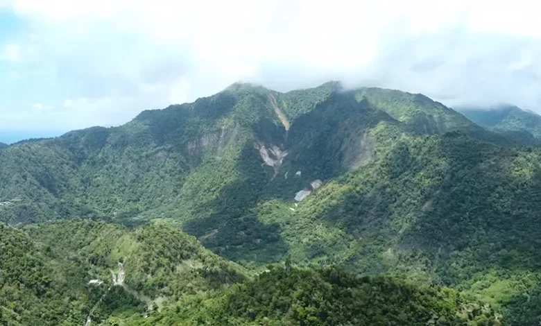
Morne Plat Pays, located in the South of Dominica and spanning across Saint Patrick Parish, Saint Mark Parish, and Saint Luke Parish, is a significant volcanic complex known for its rich geological history and natural beauty. Reaching 940 meters in height, this stratovolcano last erupted around 1270 AD. It has since been an essential feature in Dominica’s landscape, characterised by its geothermal features and an increased occurrence of seismic clusters.
Geological Significance and Surroundings
Morne Plat Pays is flanked on the west by mountains such as Morne Canotte, Morne Cabrits, Morne Acouma, and Morne Patates. This volcanic complex is among Dominica’s most active, with frequent seismic activity that plays a vital role in the island’s geological processes. It is also the source of several southern water bodies, including Am Ba Saut Ravine, Berekua Ravine, Dry Ravine, Micham River, Ravine Grand, and Ravine Sibouli. The region is further renowned for the Champagne Reef in Pointe Michel, a significant submarine hydrothermal system just off the southwest coast.
Connection to Dominica’s Natural and Cultural Landscape
Morne Plat Pays is essential not only for its geological features but also for its cultural and environmental importance. The volcanic landscape provides a stunning backdrop for various hiking trails, including the Waitukubuli Trail Segment #2, which traverses the area. The volcano’s slopes are home to diverse flora and fauna, contributing to Dominica’s rich biodiversity.